
St. Louis Park ZIP Code Directory Coverage
The Minnesota Department of Public Safety county-and-ZIP table lists four ZIP codes for St. Louis Park in Hennepin County: 55416, 55424, 55426, and 55436. This is the sourced set for the city and county row. The table is useful for identifying possible ZIPs, but it does not give a street-by-street carrier map. The state county and ZIP table should therefore be paired with an address-level USPS query before a form, parcel, or directory search relies on a ZIP.
| ZIP | Areas covered in the official table | Post-office information | St. Louis Park research note |
|---|---|---|---|
| 55416 | Listed for St. Louis Park, Hennepin County | Confirm the delivery line with USPS | No complete official street-boundary table was located |
| 55424 | Listed for St. Louis Park, Hennepin County | Confirm preferred city and alias with USPS | Address-level verification is required |
| 55426 | Listed for St. Louis Park, Hennepin County | St. Louis Park Station, 2700 Louisiana Avenue South | Carrier boundaries still require USPS lookup |
| 55436 | Listed for St. Louis Park, Hennepin County | Confirm the delivery line with USPS | Address-level verification is required |
Do not add 55439 to a St. Louis Park ZIP code directory without a source. The research did not locate an official static boundary table that assigns every city street to one of the four ZIPs, names every carrier route, or maps all preferred-city aliases. That absence matters. It means the careful result is “USPS returned this ZIP for this address on this date,” rather than an unsupported claim about an entire neighborhood.
Verify St. Louis Park ZIPs by Address
USPS ZIP Code Lookup is the address-level authority in this St. Louis Park ZIP code directory. It offers By Address, By City and State, and Cities by ZIP modes. The By Address route accepts an optional company field, street, city, and state. It standardizes the address, and a unit can be needed when several matches exist. USPS cautions that the returned ZIP does not confirm that a person or business is at the location. It only confirms the postal result for the entered address.
The official USPS lookup shows the modes used to normalize a St. Louis Park address.
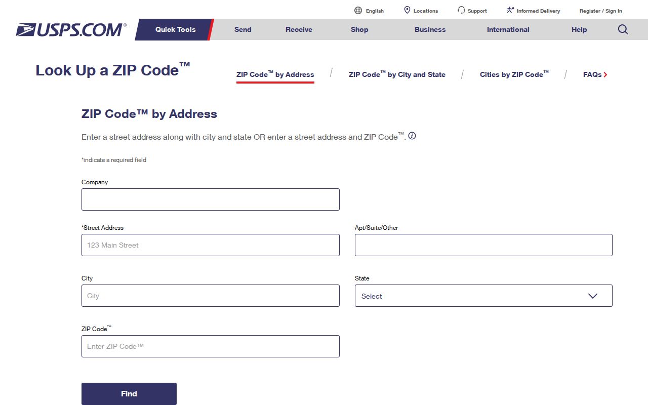
Save the entered line and the returned standardized line together. A historic directory spelling may use “Av,” omit a street type, or show a period-style ordinal. A modern postal result will not convert that old evidence automatically. Preserve the year and original spelling before testing a current equivalent through the parcel and map records.
Note: A city or ZIP alone may return several possibilities, so a full street address and unit are the safer starting fields.
Use St. Louis Park ZIP Fields
The postal form has different inputs for different questions. Use the address route when the goal is one delivery line. Use Cities by ZIP to see postal city labels attached to a ZIP, while remembering that a preferred city or acceptable alias is postal terminology rather than a municipal-boundary decision. When USPS offers multiple matches, add the unit or select the address that precisely matches the source document. These field choices keep a St. Louis Park ZIP code directory tied to the source’s real search behavior.
| By Address | Company is optional; enter street, city, and state to get a standardized delivery result. |
|---|---|
| By ZIP | Use a ZIP to check the postal city information, then return to a full address for the exact line. |
| By City and State | Use city and state to identify ZIP possibilities, not to assign every street to one ZIP. |
| Unit or apartment | Add it when the postal result needs narrowing; the same detail can be required in the voter search. |
The county property tool takes an address, 13-digit PID, addition name, or map selection, rather than a documented ZIP-only search. Its property-search instructions explain that a result can provide the situs address, PID, legal or parcel description, assessment values, sales, tax information, and recent recording links. A taxpayer or owner shown there has a specific property role, not automatic proof of occupancy.
The Hennepin assessor guidance identifies the address and parcel fields used after a postal result is confirmed.
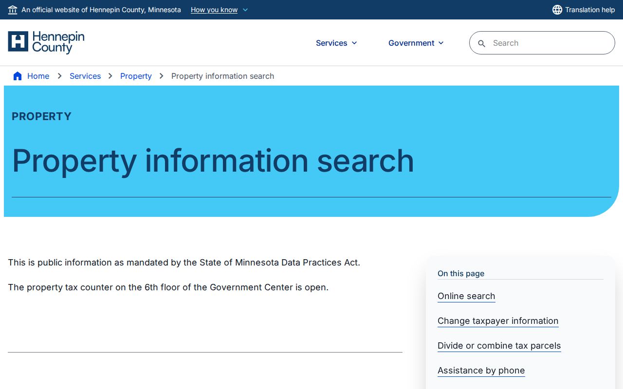
Use the PID and legal description as separate, stable parcel identifiers. They are especially useful when a street label, city alias, or historic spelling changes.
Find Residents Through St. Louis Park ZIP Codes
A ZIP narrows an address investigation but is not a public people list. Use it first to normalize a full delivery line, then connect that address to the appropriate official record. Minnesota’s individual voter lookup has a ZIP branch, but it still requires county, city or township, house number, street, and an optional unit that becomes mandatory once selected. It is an exact registration confirmation tool, not a ZIP-wide household search. The steps below keep each source within that role.
- Run the complete address through USPS and retain the standardized line, returned ZIP, and preferred-city wording.
- Use the same address in the Hennepin property search to capture the PID, situs, legal description, and the exact owner or taxpayer role shown.
- Use MyBallotMN to check the address’s precinct, district, and polling information when electoral geography is relevant.
- For an exact current registration question, enter the required name, date of birth, and complete address in the Minnesota voter lookup.
The Minnesota voter lookup shows why a St. Louis Park ZIP code alone is insufficient for a registration result.
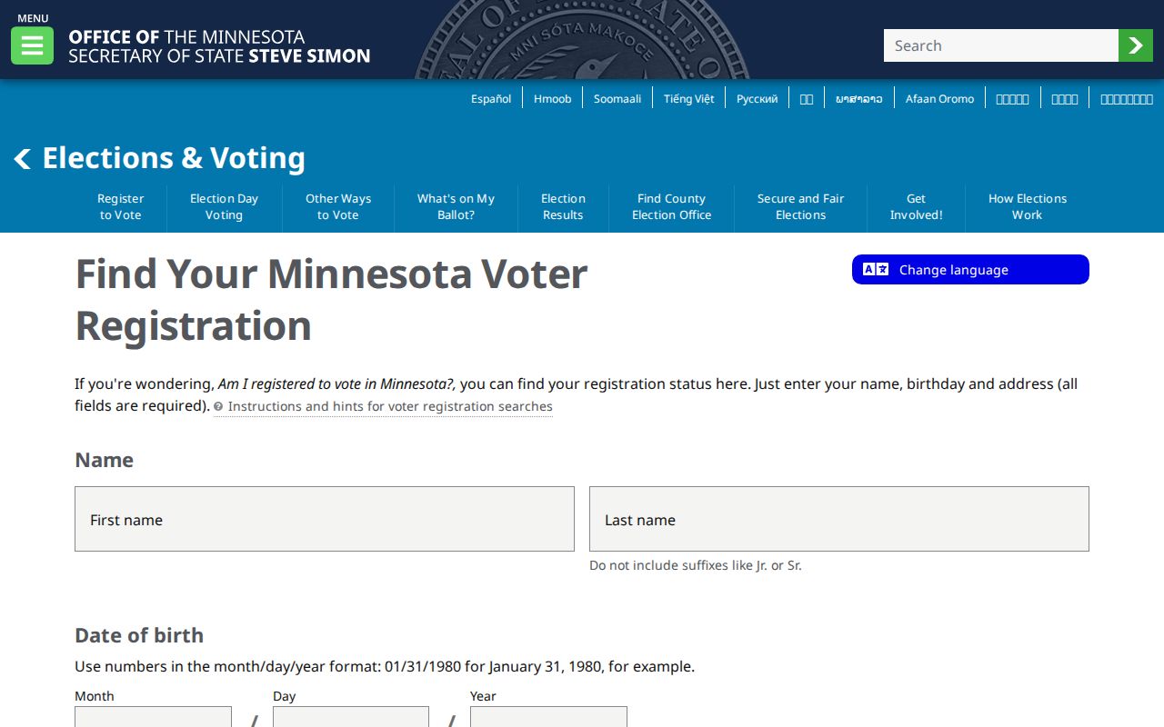
Its ZIP branch still combines a person’s name and date of birth with county, city, house number, street, and, when selected, a unit. A statewide voter-list request is a different process. Minnesota’s form includes geographic formats, but it requires requester certification for election, political, or permitted law-enforcement use. It should not be substituted for the narrower individual confirmation. Once a ZIP has narrowed the work to one street, the address-specific methods belong on the St. Louis Park street directory page.
Compare St. Louis Park ZIP, PID, Precinct
Four geographic layers can describe the same St. Louis Park address: USPS supplies the delivery line and ZIP; Hennepin supplies the parcel and PID; MyBallotMN supplies a precinct and district; the city’s neighborhood material identifies a civic planning area. They should not be collapsed into one boundary. A postal preferred city may differ from a municipal label, while a neighborhood may follow a rail line, major road, natural feature, or city edge rather than a ZIP line.
The Hennepin Property Information Search supports address, PID, addition-name, and map entry. The Hennepin Property Map then places the selected parcel beside adjacent parcels. If an old PID is needed, retain it: the county says parcel changes can result in a new PID finalized during the March-to-June period after the following assessment year. Do not use a parcel’s tax or ownership field to identify an occupant.
The property-search screen is the parcel layer that follows a confirmed ZIP and street address.
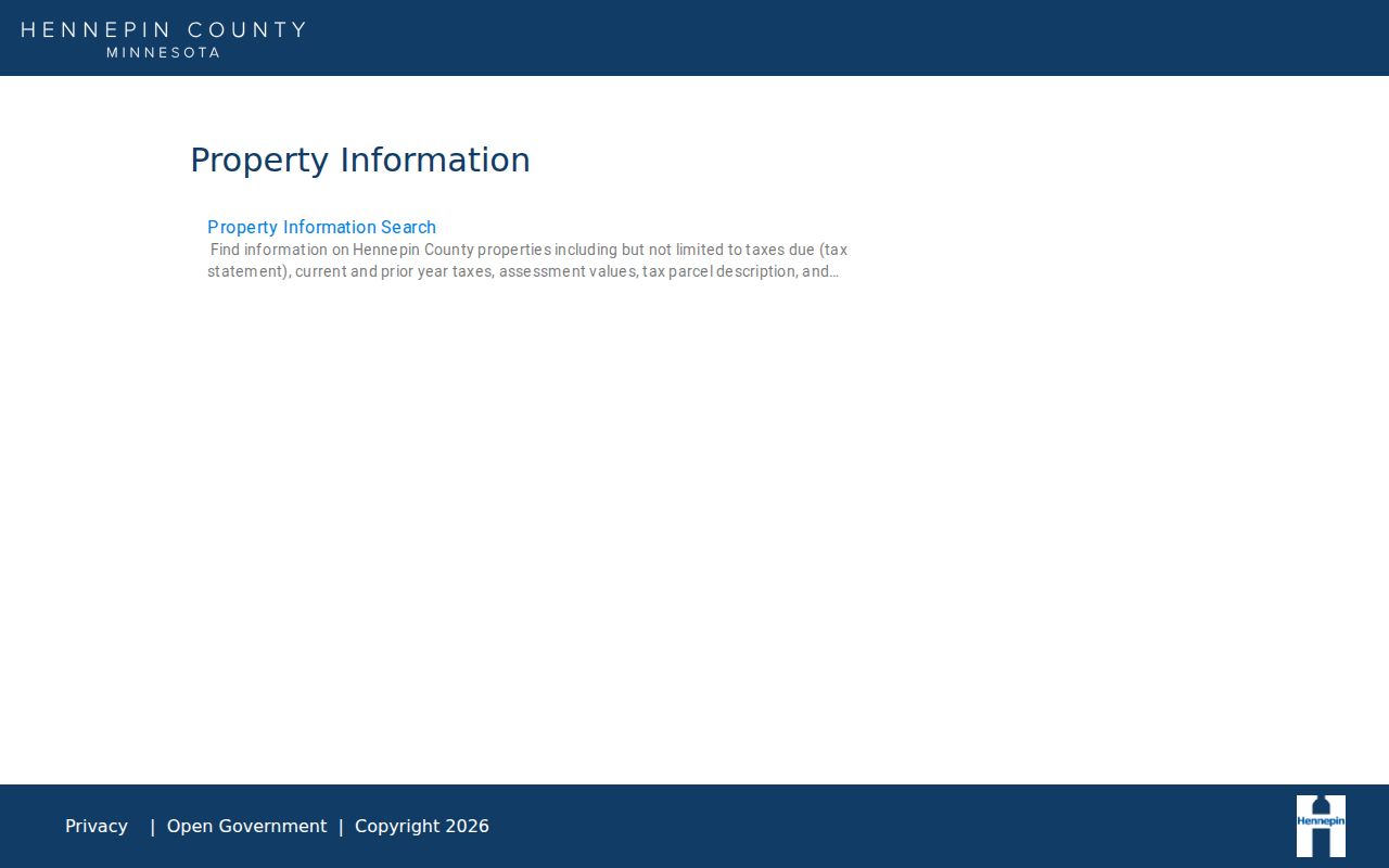
Comparing the four layers makes a mismatch visible instead of hiding it. Keep both labels when they differ and ask the relevant custodian which one controls the task at hand.
St. Louis Park ZIP Codes and City Limits
ZIP codes are delivery geography, not city limits. The Minnesota table groups ZIPs with St. Louis Park, while USPS may return a preferred city name or an acceptable alias for a particular delivery line. The research did not locate an official street-by-street carrier-boundary table for the city. That is why the ZIP code directory shows the sourced four-ZIP set but does not draw neighborhood lines or assert that all addresses in one ZIP are within the same municipal boundary.
- ZIP and ZIP+4
- A ZIP identifies a broader postal delivery area. ZIP+4 adds a more specific delivery segment to the base ZIP.
- PO-box ZIP
- A ZIP used for post-office boxes rather than a general delivery area; none is asserted for St. Louis Park without a source.
- Unique ZIP
- A ZIP assigned to one organization or large receiver. The available research does not establish one for St. Louis Park.
- Carrier route
- A postal delivery sequence. It is not a city border, a neighborhood line, or proof about a resident.
Use the city name, ZIP, parcel number, and precinct as separate labels in notes. That makes it possible to revisit a mismatch without quietly changing the original source.
Trace Historic St. Louis Park ZIP Clues
Modern ZIP search cannot solve every historic address. HCLIB directory OCR can use forms such as “Av,” period ordinal wording, and a resident prefix attached to a number. A current postal line should sit beside the address as printed in the dated source, not replace it. For an old property, compare the original directory spelling with the Hennepin PID and legal description, then inspect plats, lot and block references, adjacent numbers, a Sanborn footprint, or the city’s historic section maps.
The HCLIB researching-homes guide connects directories, clippings, newspapers, Recorder documents, and library databases. The Library of Congress item for the 1912 through July 1951 Minneapolis and Hennepin volume includes Saint Louis Park as a secondary location, with a 92-sheet and 73-image sequence. A map sheet can show a dated structure or rail context. It cannot by itself name an occupant or turn an old street label into a verified current one.
Note: Record an historic address as printed in its source year, then document any USPS or PID equivalent as something independently verified.
Count St. Louis Park Postal Geography
St. Louis Park’s population and its postal geography measure different things. The city historical table reports 7,737 people in 1940, 22,644 in 1950, and 43,310 in 1960. Census QuickFacts gives a 2025 estimate of 50,027, a 2020 base of 50,018, 10.63 square miles of land, and density of 4,705.5 people per square mile. Those figures describe the municipality on their stated dates. They do not divide residents among ZIP codes or establish the ZIP assignment of a block.
The city’s 35-neighborhood structure adds another layer. Boundaries use rail corridors, major roads, natural features, and municipal borders, with older grid patterns in the south, east, and central portions and more suburban growth in the west and north. Use the city neighborhood map for civic context and USPS for mail delivery. Keeping those roles separate makes a St. Louis Park ZIP code directory more accurate when a postal label and local neighborhood description do not match.